Special Offers
Serifos Hiking Map
Scale: 1:25.000 Edition: June 2009 It is the first map of Serifos where the island’s entire coas..
9.95€ 12.95€ -23%
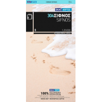
Sifnos Hiking Map
Scale: 1:20.000 Edition: June 2009 It is the first map of Sifnos where the island’s entire coast..
9.95€ 12.95€ -23%
Sigri Bay (Lesvos Island) Nautical Chart
Official Nautical Chart of Hellenic Navy Hydrographic Service of Sigri Bay (Lesvos Island)Includes:S..
19.95€ 24.95€ -20%
Sikinos Hiking Map
Scale: 1:15.000 Edition: March 2010 This map of Sikinos , comes in the detailed scale of 1:15,000,..
9.95€ 12.95€ -23%
Skala Harbour (Patmos Island) Nautical Chart
Official Nautical Chart of Hellenic Navy Hydrographic Service of Skala Harbour (Patmos Island) Scale..
19.95€ 24.95€ -20%
Skiathos Hiking Map
Scale: 1:15.000 Edition: March 2010 For the first time the island’s entire coastline is mapped w..
9.95€ 12.95€ -23%
Skopelos Hiking Map
Scale: 1:25.000 Edition: March 2010 This is the only GIS map of Skopelos made with data collecte..
9.95€ 12.95€ -23%
Skyros Hiking Map
Scale: 1:35.000 Edition: June 2009 This is the only map of the island of Skyros at such a large ..
9.95€ 12.95€ -23%
Skyros Island Nautical Chart
Official Nautical Chart of Hellenic Navy Hydrographic Service of Skyros IslandScale: 1:50.000Include..
29.95€ 34.95€ -14%
South Aegean Sea Nautical Chart
Official Nautical Chart of Hellenic Navy Hydrographic Service of South Aegean Sea Scale: 1:500.000 V..
29.95€ 34.95€ -14%
South Dodecanese Pilot Nautical Chart
Pilot Charts are nautical charts allowing the vessel to navigate accurately and safely in the Greek ..
28.95€ 34.95€ -17%
South Evoic Gulf, Kymi Bay to Kafireas Strait Nautical Chart
Official Nautical Chart of Hellenic Navy Hydrographic Service of South Evoic Gulf, Kymi Bay to Kafir..
29.95€ 34.95€ -14%
South Evoikos Nautical Chart
Official Nautical Chart of Hellenic Navy Hydrographic Service of South Evoikos Scale: 1:100.000 Vers..
29.95€ 34.95€ -14%
South Ionian Sea - Zakynthos to Cape Tainaro Nautical Chart
Official Nautical Chart of Hellenic Navy Hydrographic Service of South Ionian Sea - Zakynthos to Cap..
29.95€ 34.95€ -14%
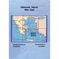
Southeastern Cyclades Pilot Nautical Chart
Pilot Charts are nautical charts allowing the vessel to navigate accurately and safely in the Greek ..
28.95€ 34.95€ -17%


